Prints - Maps

Europe Map.
19th cent. Map with political borders. 13 x 15 inches. More
Islands in Indian Ocean Map.
19th cent. Map. 11 panels on one sheet. 12 x 15 inches. More
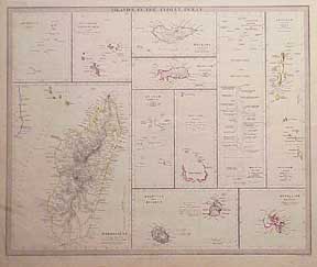
Mediterranean Islands Map.
19th cent. Map. Three panels on one sheet. No Slcily. 12 x 15 inches. More
New England Map.
1860. Map. New York, Vermont, Rhode lsland, New Hampshire and Connecticut. 13 x 21 inches. More
Australia in 1846.
London: Society for the Diffusion of Useful Knowledge, [1846]. 3 Maps. Engraved. Hand-colored outlines. 15 x 12 inches & 17 x 14 inches. Printed by Charles Knight & Co. More
Bokhara Map.
London: Society for the Diffusion of Useful Knowledge, [1844]. Map. Engraved. Hand-colored outlines. 15 x 12 inches. Printed by Charles Knight & Co. With Kabool and Beloochistan. More
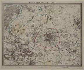
The Environs of Paris Map.
London: Society for the Diffusion of Useful Knowledge, [1840]. Engraved map. Outline color. Printed by Charles Knight & Co. Matted. 32 x 38 cm. More
Germany Deutschland and Austrian Dominions Map.
London: Society for the Diffusion of Useful Knowledge, [1843]. Seven maps. Engraved. Hand-colored outlines. 14 x 17 inches. Printed by Charles Knight & Co. More
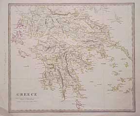
Greece Map.
London: Society for the Diffusion of Useful Knowledge, [1844]. Map. Engraved. Hand-colored outlines. 14 x 17 inches. Printed by Charles Knight & Co. More
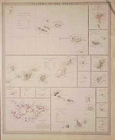
Islands in the Atlantic Map. Azores. Canary Islands. Falkland.
London: Society for the Diffusion of Useful Knowledge, [1844]. Map. 16 panels on one sheet. Engraved. Hand-colored outlines. 17 x 14 inches. Printed by Charles Knight & Co. More
Islands in the Indian Ocean.
London: Society for the Diffusion of Useful Knowledge, [1844]. Map. Engraved. Hand-colored outlines. 14 x 17 inches. Printed by Charles Knight & Co. More
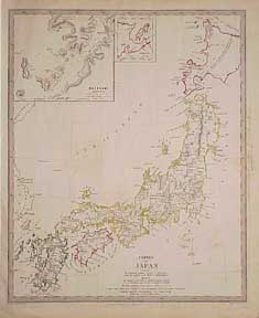
Japan Map.
London: Society for the Diffusion of Useful Knowledge, [1844]. Map. Engraved. Hand-colored outlines. 17 x 14 inches. Printed by Charles Knight & Co. Empire of Japan. Inset of Nagasakl harbor. More
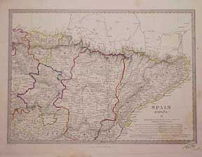
Map of Spain.
London: Society for the Diffusion of Useful Knowledge, [1844]. 3 engraved maps. Hand-colored outlines. 17 x 14 inches. Printed by Charles Knight & Co. More
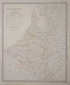
Netherlands and Belgium Map.
London: Society for the Diffusion of Useful Knowledge, 1831. Map. Engraved. Hand-colored outlines. 17 x 14 inches. Printed by Charles Knight & Co. More
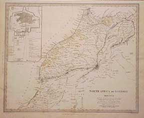
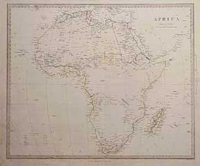
North Africa Maps.
London: Society for the Diffusion of Useful Knowledge, [1844]. 5 maps. Engraved. Hand-colored outlines. 14 x 17 inches. Printed by Charles Knight & Co. Morocco, Algier, Tunis, Tripoli to Egypt. More
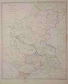
Poland Polska Map.
London: Society for the Diffusion of Useful Knowledge, 1831. Map. Engraved. Hand-colored outlines. 17 x 14 inches. Printed by Charles Knight & Co. More
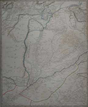
Punjab with part of Afghanistan Map.
London: Society for the Diffusion of Useful Knowledge, [1844]. Map. Engraved. Hand-colored outlines. 14 x 17 inches. Printed by Charles Knight & Co. Also Kashmeer & Slnde. Good with foxing, minor staining, marginal tear. More
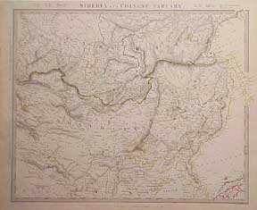
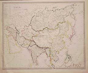
Siberia and Tartary Map.
London: Society for the Diffusion of Useful Knowledge, 1846. Map. Engraved. Hand-colored outlines. 14 x 17 inches. Printed by Charles Knight & Co. With Mongolia. More
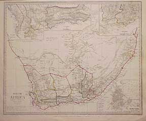
South Africa Map.
London: Society for the Diffusion of Useful Knowledge/ Charles Knight & Co., [1844]. Map. Engraved. Hand-colored outlines. 17 x 14 inches. Inset of Capetown. More
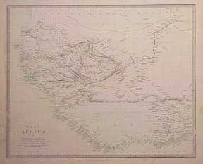
West Africa Map.
London: Society for the Diffusion of Useful Knowledge, [1844]. 2 maps. 14 x 17 in. Engraved. Hand-colored outlines. Printed by Charles Knight & Co. More
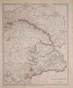
France Map.
London: Society for the Diffusion of Useful Knowledge, [1840]. Four maps. Each province with hand colored border. Engraved. 14 x 17 inches. Printed by Charles Knight & Co. More
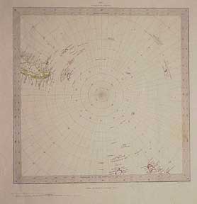
World Map. On Gnomic Projection.
London: Society for the Diffusion of Useful Knowledge, [1844]. Six separate maps. Engraved. Hand-colored outlines. 11 x 10.5 inches & 17 x 14 inches. Printed by Charles Knight & Co. More