
Europe Map.
Philadelphia, Pa.: S. Augustus Mitchell, 1860. Map with political divisions. Engraved. Colored. 13 x 15 inches. More
Philadelphia, Pa.: S. Augustus Mitchell, 1860. Map with political divisions. Engraved. Colored. 13 x 15 inches. More
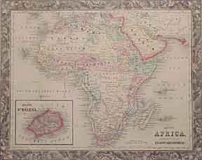
Philadelphia, Pa.: S. Augustus Mitchell, 1860. Map. Engraved. Colored. 13 x 15 inches. West Africa. More
Philadelphia, Pa.: S. Augustus Mitchell, 1860. Map. Engraved. Colored. 16 x 24 inches. Shows Boston and New York harbors. More
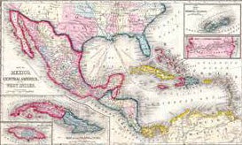
Philadelphia, Pa.: S. Augustus Mitchell, 1860. Map. Engraved. Colored. 15.5 x 24.5 inches. Mexico, Central America and West Indies. Insets: Cuba and Jamaica. More
Philadelphia, Pa.: Mitchell, S. Augustus, 1860. 3 maps showing political divisions. Engraved. Colored. 13 x 11 inches. More