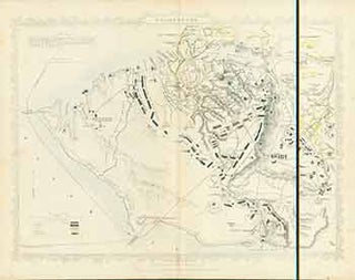
Siege of Sebastopol (Map).
London: London Printing And Publishing Company, [1860s - 1890s?]. 11 x 14 inches. Very Good. Minor foxing. Folded, hand-colored map of Siege of Sebastopol. Drawn and engraved from official documents. More
London: London Printing And Publishing Company, [1860s - 1890s?]. 11 x 14 inches. Very Good. Minor foxing. Folded, hand-colored map of Siege of Sebastopol. Drawn and engraved from official documents. More
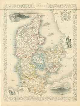
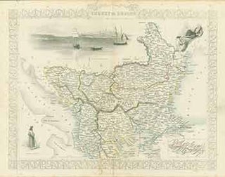
London: London Printing And Publishing Company, [1860s - 1890s?]. 11 x 14 inches. Very Good. Minor foxing. Folded, hand-colored map of Denmark. More
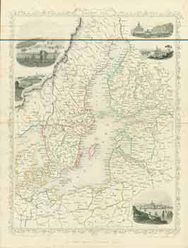
London: London Printing And Publishing Company, [1860s - 1890s?]. 11 x 14 inches. Very Good. Minor foxing. Folded, hand-colored map of Baltic Sea. More
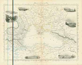
London: London Printing And Publishing Company, [1860s - 1890s?]. 11 x 14 inches. Very Good. Minor foxing. Folded, hand-colored map of Black Sea. More
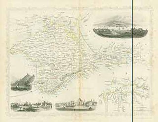
London: London Printing And Publishing Company, [1860s - 1890s?]. 11 x 14 inches. Very Good. Minor foxing. Folded, hand-colored map of The Crimea. More
London: London Printing And Publishing Company, [1860s - 1890s?]. 11 x 14 inches. Very Good. Minor foxing. Folded, hand-colored map of Turkey in Europe. More
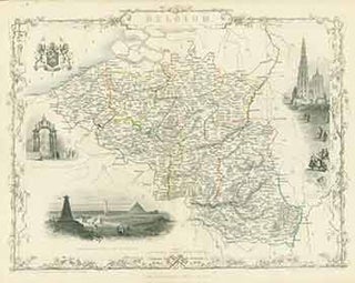
London: John Tallis & Company, [1860s - 1890s?]. 11 x 14 inches. Very Good. Folded, hand-colored map of Belgium. More
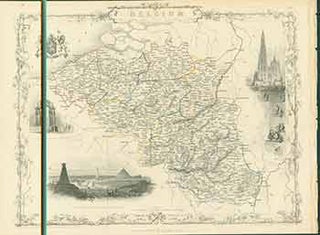
London: London Printing And Publishing Company, [1860s - 1890s?]. 11 x 14 inches. Very Good. Folded, hand-colored map of Belgium. More
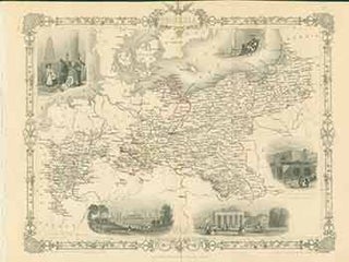
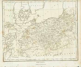
London: London Printing And Publishing Company, [1860s - 1890s?]. 11 x 14 inches. Very Good. Folded, hand-colored map of Prussia. More
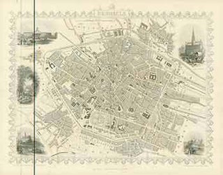
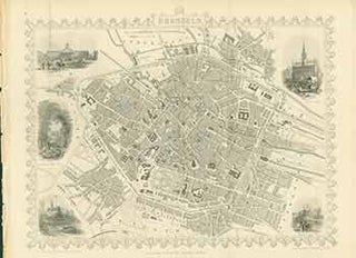
London: John Tallis & Company, [1860s - 1890s?]. 11 x 14 inches. Very Good. Folded, illustrated map of Brussels. More
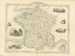
London: John Tallis & Company, [1860s - 1890s?]. 11 x 14 inches. Very Good. Some wrinkling to right edge. Folded, hand-colored map of France. More
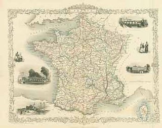
London: John Tallis & Company, [1860s - 1890s?]. 11 x 14 inches. Very Good. Folded, hand-colored map of France. More
London: John Tallis & Company, [1860s - 1890s?]. 11 x 14 inches. Very Good. Folded, hand-colored map of France. More
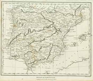
London: London Printing and Publishing Company, [1800s]. 15 x 11 inches. Very Good. 19th Century, folded, hand colored map. Scarce. More
London: London Printing and Publishing Company, [1800s]. 15 x 11 inches. Very Good. 19th Century, folded, uncolored map. Scarce. More
London: J. Wilkes, [1816?]. 8 x 10 inches. Very Good. Minor foxing. Fine copperplate engraving. 19th Century, uncolored map. “Published as the Act directs 5 Jan [1816].” Scarce. More
London: J. Wilkes, [1809]. 8 x 10 inches. Very Good. Some wrinkling at top margin, not affecting image. Fine copperplate engraving. 19th Century, uncolored map. “Published as the Act directs 13th Oct 1809.” Scarce. More
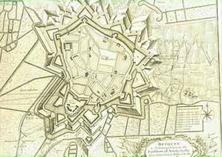
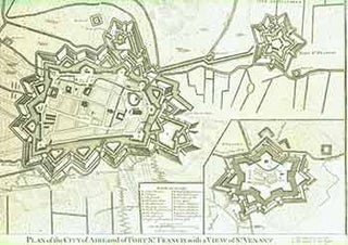
[London]: 18th Century European Publisher, [1743]. 20 x 16 inches. Very Good. Three inch tear and repair along fold at bottom. Fine copperplate engraving. Old antique battle plan showing the bastions rivers canals and fortifications outside the city and shellings during the Spanish Succession War between the French, Spanish and..... More
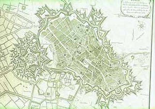
[London]: 18th Century European Publisher, [1740s]. 21 x 17 inches. Very Good. Minor loss on bottom left corner, not affecting image. Half inch tears in bottom and right margins. Fine copperplate engraving. 18th Century, uncolored, folded map. Paul de Rapin’s, The History of England by Nicholas Tindall. Douai France Old..... More
[London]: 18th Century European Publisher, [1745]. 20 x 16 inches. Very Good. Fine copperplate engraving. 18th Century, uncolored, folded map. Paul de Rapin’s, The History of England by Nicholas Tindall. Paul de Rapin (25 March 1661 – 25 April 1725), sieur of Thoyras (and therefore styled Thoyras de Rapin), was..... More
[London]: 18th Century European Publisher, [1743]. 20 x 16 inches. Very Good. Three inch tear and repair along fold at bottom. Fine copperplate engraving. 18th Century, uncolored, folded map. Paul de Rapin’s, The History of England by Nicholas Tindall. Paul de Rapin (25 March 1661 – 25 April 1725), sieur..... More
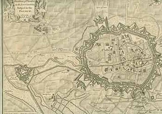
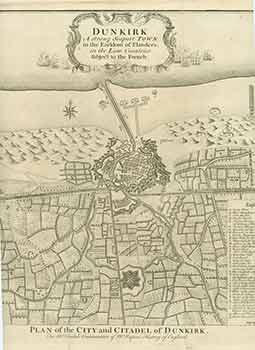
[London]: 18th Century European Publisher, [1740s]. 20 x 16 inches. Very Good. Appears to be trimmed at bottom edge and may have lost some text. Fine copperplate engraving. 18th Century, uncolored, folded map. Paul de Rapin’s, The History of England by Nicholas Tindall. Douai France Old antique Plan of The..... More

[London]: 18th Century European Publisher, [1740s]. 20 x 16 inches. Very Good. Fine copperplate engraving. 18th Century, uncolored, folded map. Paul de Rapin’s, The History of England by Nicholas Tindall. The famous Battle of Blenheim (known on the Continent as the Second Battle of Höchstädt), during the war of the..... More
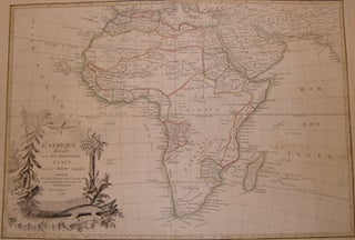
Paris, France: Janvier, 1782. Engraving. Laid Paper. 20.25" x 14". Very Good. En Francais. More
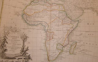
Paris, France: Janvier, 1782. Copperplate Engraving. Laid Paper. 14.25" x 20". Good with tiny tear, minor toning, repair to lower right corner. Text En Francais. More