Stadtplan von Lüttich. Plan de Liège.
ca. WWII. Color lithograph. Military map. Main image 76 x 78 cm. Scale 1:10 000. More
ca. WWII. Color lithograph. Military map. Main image 76 x 78 cm. Scale 1:10 000. More

ca. 1914. Map of Alameda County, California with inset views. 18.5 x 31.5 inches. More
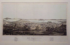
San Francisco, Calif.: Henry Bill, 1856. Color lithograph. Published for The History of the World. Image: 7.5 x 16 inches. Fold marks. In carved wooden frame. More
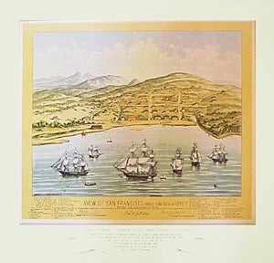
San Francisco, Calif., ca. 1950s. Map. Reproduction of the map originally published by Capt. W. Swasey in 1847. 25.25 x 25.25 inches. More
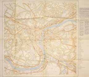
Southern Pacific Railroad, May 18, 1927. Map. Blueprint. Showing Trackage and Facilities of City of Los Angeles, Southern Pacific R.R., Pacific Electric RY, Los Angeles and Salt Lake R.R., etc. More
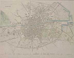
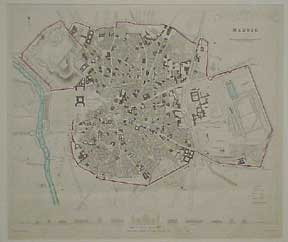
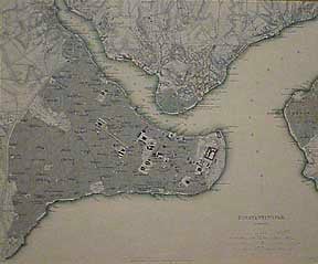
London: Society for the Diffusion of Useful Knowledge, [1840]. Engraved map with inset engravings of buildings. Outline color. Printed for Charles Knight & Co. 32 x 40 cm. Matted. Turrell. W. [Engraver]. More
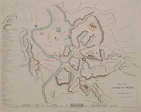
London: Society for the Diffusion of Useful Knowledge, [1840]. Engraved map with inset view. Outline color. Printed by Charles Knight & Co. Matted. More

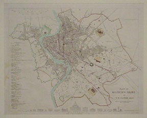
London: Society for the Diffusion of Useful Knowledge, [1840]. Engraved map with inset views. Outline color. Printed by Charles Knight & Co. Matted. More
London: Society for the Diffusion of Useful Knowledge, [1840]. Engraved map with inset view. Outline color. Printed by Charles Knight & Co. Matted. More
London: Society for the Diffusion of Useful Knowledge, [1840]. Engraved map with inset view. Outline color. Printed by Charles Knight & Co. Matted. More
![Item #01-0322 Plan of [Ancient] Athens Map. Willene B. Clark](https://art-books.cdn.bibliopolis.com/pictures/01-0322.jpg?width=320&height=427&fit=bounds&auto=webp&v=1342481391)
London: Society for the Diffusion of Useful Knowledge, [1840]. Engraved map with inset view. Outline color. Printed by Charles Knight & Co. Matted. More
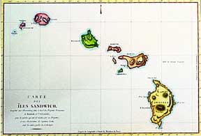
20th cent. Hand-colored facsimile of an 18th century map from the Atlas du Voyage de la Pérouse. 20 x 26 inches. More
London: Society for the Diffusion of Useful Knowledge, ca. 1840. Engraved map. Outline color. Printed for Charles Knight & Co. Matted. 32 x 39 cm. More
London: Society for the Diffusion of Useful Knowledge, [1840]. Engraved map. Outline color. Printed by Charles Knight & Co. Matted. More
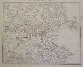
![Item #01-0329 The Environs of Edinburgh [map]. B. R. Davies, engraver](https://art-books.cdn.bibliopolis.com/pictures/01-0329.jpg?width=320&height=427&fit=bounds&auto=webp&v=1342481401)
London: Society for the Diffusion of Useful Knowledge, [1840]. Engraved map. Outline color. Printed for Charles Knight & Co. Matted. 31 x 39 cm. More
London: Society for the Diffusion of Useful Knowledge, [1840]. Engraved map with inset view. Outline color. Printed by Charles Knight & Co. Matted. More
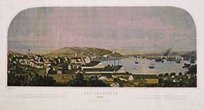
San Francisco, Calif., ca. 1940s. Reproduction of view originally published by W. H. Jones. 10 x 22 inches. More
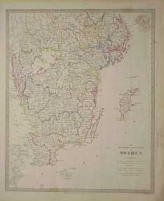
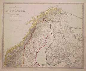
London: Society for the Diffusion of Useful Knowledge, [1843]. 2 maps. Printed by Charles Knight & Co. 17 x 14 inches. Engraved. Hand-colored outlines. Also part of Norway. More
1787. Color facsimile map, mounted on masonite. 17.5 x 23 inches. More
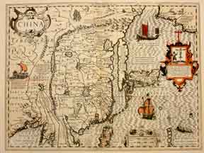
San Francisco, Calif., 1936. With a facsimilie of map of China attributed to Mercator, 1636 and a proposal by John Speed, 1627. Printed by the Grabhorn Press. One of 100 copies. Grabhorn Press no. 250. Presentation copy to the Roxburghe Club. Original wraps. More
![Item #01-0328 Birmingham [map]. J. Henshall, engraver](https://art-books.cdn.bibliopolis.com/pictures/01-0328.jpg?width=320&height=427&fit=bounds&auto=webp&v=1342481400)
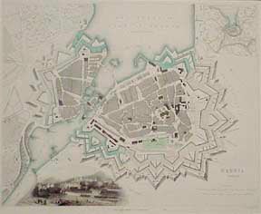
London: Society for the Diffusion of Useful Knowledge, [1840]. Engraved map with inset renderings of buildings. Outline color. Printed by Henshall. Matted. 33 x 40 cm. More
20th cent. Facsimile. Nova Africae. Tabula panel arts on top and sides. 1617. 16 x 23 inches. More
London: Chas. Knight, 1834. Map. Hand-colored lithograph. 17 x 14 inches. Oblong. Good with marginal tears, minor toning. More
Aberdeen: Keith and Gibb, 1806. Map. 80 x 50 cm. Abuts River Tay. Belonging to Francis Garden Campbell. More
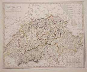
London: Society for the Diffusion of Useful Knowledge, [1844]. Engraved map. Printed by Charles Knight & Co. 14 x 17 inches. Hand-colored outlines. Inset -Height of Prlncipal Mountalns/ passes. More