![Item #16-5068 Topographia Galliae, Oder Beschreibung und Contrafaitung der vornehmbsten/ und bekantisten Oerter/ in dem mächtigen/ und grossen Königreich Franckreich / Beedes auß eygner Erfahrung/ und den besten/ und berühmbtesten Scribenten ... zusammen getragen ... und ... zum Druck verfertiget/ durch Martinum Zeillerum. [BOUND WITH] M.Z. Topographiae Galliae. oder Beschreibung, und Contrafaytung deß Mächtigen Königreichs Franckreich. Zweyter Theil Die fürnehmste und bekantiste Stätte und Plätze in der Provinc Picardiae : Wie auch den andern Eingang von gemelten Königreich, auch deßen Regirung und fürnehmbste Ämbtern fürstellend...First editions. Martin Zeiler, artist Johan Peeters, publisher Caspar Merian.](https://art-books.cdn.bibliopolis.com/pictures/16-5068_2.jpg?width=768&height=1000&fit=bounds&auto=webp&v=1668795014)
![Topographia Galliae, Oder Beschreibung und Contrafaitung der vornehmbsten/ und bekantisten Oerter/ in dem mächtigen/ und grossen Königreich Franckreich / Beedes auß eygner Erfahrung/ und den besten/ und berühmbtesten Scribenten ... zusammen getragen ... und ... zum Druck verfertiget/ durch Martinum Zeillerum. [BOUND WITH] M.Z. Topographiae Galliae. oder Beschreibung, und Contrafaytung deß Mächtigen Königreichs Franckreich. Zweyter Theil Die fürnehmste und bekantiste Stätte und Plätze in der Provinc Picardiae : Wie auch den andern Eingang von gemelten Königreich, auch deßen Regirung und fürnehmbste Ämbtern fürstellend...First editions.](https://art-books.cdn.bibliopolis.com/pictures/16-5068_3.jpg?auto=webp&v=1668795013)
![Topographia Galliae, Oder Beschreibung und Contrafaitung der vornehmbsten/ und bekantisten Oerter/ in dem mächtigen/ und grossen Königreich Franckreich / Beedes auß eygner Erfahrung/ und den besten/ und berühmbtesten Scribenten ... zusammen getragen ... und ... zum Druck verfertiget/ durch Martinum Zeillerum. [BOUND WITH] M.Z. Topographiae Galliae. oder Beschreibung, und Contrafaytung deß Mächtigen Königreichs Franckreich. Zweyter Theil Die fürnehmste und bekantiste Stätte und Plätze in der Provinc Picardiae : Wie auch den andern Eingang von gemelten Königreich, auch deßen Regirung und fürnehmbste Ämbtern fürstellend...First editions.](https://art-books.cdn.bibliopolis.com/pictures/16-5068_4.jpg?auto=webp&v=1668795012)
![Topographia Galliae, Oder Beschreibung und Contrafaitung der vornehmbsten/ und bekantisten Oerter/ in dem mächtigen/ und grossen Königreich Franckreich / Beedes auß eygner Erfahrung/ und den besten/ und berühmbtesten Scribenten ... zusammen getragen ... und ... zum Druck verfertiget/ durch Martinum Zeillerum. [BOUND WITH] M.Z. Topographiae Galliae. oder Beschreibung, und Contrafaytung deß Mächtigen Königreichs Franckreich. Zweyter Theil Die fürnehmste und bekantiste Stätte und Plätze in der Provinc Picardiae : Wie auch den andern Eingang von gemelten Königreich, auch deßen Regirung und fürnehmbste Ämbtern fürstellend...First editions.](https://art-books.cdn.bibliopolis.com/pictures/16-5068_6.jpg?auto=webp&v=1668795011)
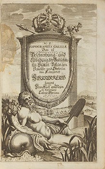
Topographia Galliae, Oder Beschreibung und Contrafaitung der vornehmbsten/ und bekantisten Oerter/ in dem mächtigen/ und grossen Königreich Franckreich / Beedes auß eygner Erfahrung/ und den besten/ und berühmbtesten Scribenten ... zusammen getragen ... und ... zum Druck verfertiget/ durch Martinum Zeillerum. [BOUND WITH] M.Z. Topographiae Galliae. oder Beschreibung, und Contrafaytung deß Mächtigen Königreichs Franckreich. Zweyter Theil Die fürnehmste und bekantiste Stätte und Plätze in der Provinc Picardiae : Wie auch den andern Eingang von gemelten Königreich, auch deßen Regirung und fürnehmbste Ämbtern fürstellend...First editions.
Franckfurt am Mayn: Caspar Merians, 1655-1656. Small folio. 19 x 30 cm. Contemporary calf with gilt spine and 6 raised bands; Age worn but solid with loss at foot of spine at top.
Two works bound together: First part: [2], 97, [6] pp. with numerous engravings. Second part [4], 35, [3] pp. with numerous engravings. The engravings include maps, views of buildings and towns and town plans....The plates are not numbered...
OCLC Numbers 1292069102 and 93034251....
UK Royal Collection description:
This volume, part of a set on the topography of France, was first published in 1655. It covers Paris and the Ile de France, and includes numerous detailed engravings and maps of the various cities, towns, and notable buildings in the region, accompanied by text written by the German scholar Martin Zeiler (1589-1661).....
Zeiler was born in central Austria in 1589 but his family, being Protestant, was forced to leave the country and as a result Zeiler was educated in the city of Ulm. He later moved to Wittenberg to study law and history but returned to Ulm in 1629 and began to publish multiple works on history and topography. Around 1640, Zeiler was approached by the publisher and engraver Matthäus Merian (1593-1650) to write the text for his multi volume work which aimed to collate his many detailed engravings of German, French and Italian towns. The enterprise ran to over 60 volumes, a huge endeavour for the seventeenth century, and employed notable engravers such as Wenceslaus Hollar. Merian died in 1650 but his sons managed to complete the publication with the final volume published soon after Zeiler's death in 1661....
The engravings in these volumes are very detailed and often depict birds-eye or panoramic views of cities and notable estates throughout France and the Holy Roman Empire. This volume is of particular interest because it contains very detailed depictions of the development of Paris between 1620 and 1655, most notably the progress of Louis XIII's extension of the Louvre which was completed in 1638. There have also been later additions to the engravings contained in the volume, a previous owner has inserted cropped plans and elevations of Les Invalides, a project that was not started until 1670. Item #16-5068
Price: $4,250.00